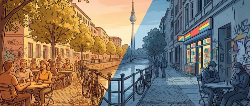
Sun, not shade
We analyze 550,000 buildings and 434,000 trees to show you which venues are sunny right now.
The Problem
Finding a sunny seat in Berlin is guesswork. You pick a café, walk there, and hope the terrace isn't in shadow. With dense buildings and trees, even locals can't predict which spots will be sunny an hour from now.
Our Solution
We use 3D building data from Berlin's official LIDAR survey and tree data from the city's tree registry (Baumkataster). Every night, our system calculates shadow patterns for the next 14 days, checking each venue every 5 minutes. The result: gold markers for sunny spots, gray for shaded ones.
How the Shadow Calculation Works
Every night at 3 AM, our pipeline computes the sun's exact position for Berlin's latitude and longitude at every 5-minute interval from sunrise to sunset. For each of those moments, it casts rays from the sun through all 550,000 building polygons in Berlin's official LoD2 city model, a dataset where every rooftop, wall, and overhang has been measured by LIDAR to sub-meter accuracy. Any venue that falls within a building's projected shadow is marked as shaded for that interval.
Trees make shadows too. Berlin's Baumkataster provides the species, trunk height, and crown diameter for 434,000 street and park trees. Our engine models each tree as a crown shape adjusted for species type. Deciduous trees get reduced shadow coverage in early spring and late autumn when leaves are sparse, while conifers cast year-round shadows. This seasonal adjustment means the results shift naturally as Berlin moves through the year.
The output is a compact bitstring for each venue: one bit per 5-minute interval, where "1" means sunny and "0" means shaded. These bitstrings are uploaded to a CDN and cached for 14 days, so your browser never runs shadow computation. It reads the precomputed result and shows you gold or gray markers instantly.
The Data
Data Sources
Building Data
Berlin 3D LoD2 city model with LIDAR-measured building heights. Licensed under dl-de/by-2.0.
View source(opens in new tab)Tree Data
Berlin Baumkataster (tree registry) with species, height, and crown radius. Licensed under dl-de/by-2.0.
View source(opens in new tab)Venue Data
OpenStreetMap venues including cafés, bars, restaurants, parks, and playgrounds. Licensed under ODbL.
View source(opens in new tab)Data licensed under Datenlizenz Deutschland - Namensnennung - Version 2.0 (dl-de/by-2.0) and Open Database License (ODbL).
Frequently Asked Questions
How accurate is Berlin Sun Seeker?
The shadow calculation uses LIDAR-measured 3D buildings accurate to sub-meter level and 434,000 individually catalogued trees. For permanent structures, accuracy is very high. Limitations include temporary structures (construction scaffolding, market stalls), very recent tree changes not yet in the registry, and awnings or parasols that aren't part of the building model.
Which Berlin areas get the most sun?
It depends on the time of day and surrounding buildings. South-facing terraces in areas with lower buildings, like parts of Friedrichshain, Neukölln, and Prenzlauer Berg, tend to get more total sun hours. But the sunniest spot changes throughout the day, which is exactly what this tool shows you in real time.
How does the shadow calculation work?
We compute the sun's position for Berlin's coordinates at every 5-minute interval, then cast rays through 550,000 3D building polygons and 434,000 tree models. If a venue falls in a projected shadow, it's marked shaded. The entire calculation runs nightly on a server. Your browser just reads the precomputed results.
Is Berlin Sun Seeker free?
Yes, completely free. No accounts, no ads, no premium tier. It's a passion project built on Berlin's open data. The building data, tree data, and venue data are all published under open licenses by the Berlin Senate and OpenStreetMap contributors.
How often is the data updated?
Shadow data is recalculated every night at 3 AM for the next 14 days. Venue data (names, locations, types) is refreshed weekly from OpenStreetMap. Tree and building data follows the city's official update schedule.
What data sources are used?
Three main sources: Berlin's 3D LoD2 city model (550,000 buildings, licensed under dl-de/by-2.0), Berlin's Baumkataster tree registry (434,000 trees, dl-de/by-2.0), and OpenStreetMap for venue locations and metadata (ODbL license).
About Berlin Sun Seeker
Berlin Sun Seeker was built by Sampo, a data scientist living in Berlin since 2015. After years of arriving at café terraces only to find them in shadow, the idea was simple: Berlin publishes incredibly detailed 3D building data and a complete tree registry. Why not use it to solve the sunny seat problem? What started as a weekend experiment with raycasting and open data became this tool, used by Berliners and visitors to find their spot in the sun.
Have feedback or spotted a bug?
This is a hobby project built by one person. I'd love to hear your thoughts: feature ideas, bug reports, or just a kind word.